Hazardous weather condition(s):
Avalanche WarningHazardous Weather OutlookWinter Storm WarningTonight: Occasional snow with areas of blowing snow. Low around 10. Wind chill values as low as -12. Breezy, with a southwest wind around 28 mph, with gusts as high as 39 mph. Chance of precipitation is 100%. Total nighttime snow accumulation of 6 to 10 inches possible. Sunday: Occasional snow with areas of blowing snow. High near 19. Wind chill values as low as -12. Breezy, with a west southwest wind between 24 and 29 mph, with gusts as high as 40 mph. Chance of precipitation is 100%. New snow accumulation of 4 to 8 inches possible.
This is the forecast as of 6:02 pm on December 29th for a location at 8,640 ft, 10 miles NE of Driggs, Idaho. Grand Targhee.
I'm not getting too overly excited about this at the moment because so often when a forecast looks promising, it doesn't end up delivering. However, this storm appears to have a pretty big punch. It's not often that a storm like this presents itself on a weekend when I am not working and not travelling somewhere else so I am, of course, anxiously awaiting tomorrow.
Stay tuned...
12 Glory Laps in 12 Hours
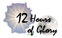
Last February 20th, I hiked and skied 12 laps on Mt. Glory. 19,638 feet climbed with skis on my back and 19,638 feet skied to raise money for Camp To Belong. It's snowing again and I'm ready for the 2nd edition! Click the logo for more info and ways to support camp!
Camp To Belong - Elk Mountain Grand Traverse

We're racing the Elk Mtn Grand Traverse this March, a 40 mile ski race across the roof of Colorado in the middle of the night! Click for updates on our training and fundraising progress!
Peaked Sports

Driggs, ID
Saturday, December 29, 2007
Friday, December 28, 2007
Ruckle Ridge

Below are photos from Ruckle Ridge. With family and friends working on Christmas Eve, I decided to get up early and drive into the Gorge to do one of my favorite trails before meeting up with family later that evening. With a planned loop up Ruckle Ridge then down Eagle Creek, I knew the success of this route would depend on the amount of snow on the ground once I arrived at the Benson Plateau at 3600 ft. I hadn't been keeping close tabs on the weather in the area over the past month, but I knew there had been a number of cold, wet storms that had moved through the area so I expected to get into some snow. The main question was 'how much'. Route finding would be difficult if the trail was covered, but hopefully there would be blazes or ribbons or some sort of trail markings on the trees. If conditions were too adverse, I knew I could go back down the ridge or take the paralleling Ruckle Creek trail.
 The trail 20 minutes up
 The trail 40 minutes up
 A natural bird bath


 The "bridge" I used to cross the creek on all fours


 Ruckle Creek
 This is the original Columbia River Highway that has since been repaired and is now maintained as a pedestrian/cycling path. I followed this section maybe a quarter mile before taking the final section of trail that would lead me back to my original trailhead.
 And after 5 1/2 hours I was done. A bit disappointed I wasn't able to complete my original route, but extremely happy with the loop I did. Great run and afterwards, I met up with family to spend Christmas Eve together. Merry Christmas Eve!
Thursday, December 27, 2007
Christmas
 Snow in Portland?!?! On Christmas?!?! Yup. C'mon, sing with me...
 "I'm . . . dreaming . . . of a white . . .
 This is a selection of art given to me by my best friend's 5 year old daughter while I was visiting them at their house. She did all of this herself without any suggestions from anyone. The two things I like most are the spelling of the words (the small strip on the far left of this picture above Buddy's tail reads: HO HO HO SANTU KLOS) and that she accurately left one of Buddy's legs off.
This is gauffe(sp?), a traditional french holiday cookie that my family has been making for years.
Gaufrette
Part of Speech: n
Definition: a thin crisp fan-shaped French wafer, often served alongside a dessert.
Ever since I can remember, when Thanksgiving rolls around, our family starts making this stuff and we munch on it through Christmas. Can't say it has much healthy nutritional value, but it sure is delicious!

The epitomy of children at Christmastime: Giving a big hug whilst holding a gun. (In this case, a gun that shoots nerf-like foam tubes with suction cups on the ends. No shooting your eye out !)

The fam
Wednesday, December 26, 2007
Mt. Tabor Hill Workout - Portland, OR
Things just seemed to work out this year and I was able to make a trip to Portland to visit my family over Christmas. So after leaving Victor around 2pm on Friday, Reba the Jeep and I drove the 5 1/2 hours accross the spud state to Boise where I was to catch a 8:30 flight to the City of Roses. I'll bet it'll be raining. Mmmmmmmmm, I can taste that thick marine air already... It felt great to be on my way there.
I arrived. It was raining. I was not surprised. My parents picked me up and we stopped at McMennimins at Edgefield so I could have dinner. Yum-yum, after a Ruby Ale and a mushroom-swiss dungeon-burger with fries, I was all set! Welcome back to Portland Me! Zzzzzzzzzzzzzzzz... Sleepy now... We went home and after briefly chatting some more with the parents, I was happy to crawl right into bed with Ms. Rubyale and Mr. Mushroomswissburger cozied up inside me listening to the rain hit the window. Ahhhhhhhhhh... snuggly. = )
I arrived. It was raining. I was not surprised. My parents picked me up and we stopped at McMennimins at Edgefield so I could have dinner. Yum-yum, after a Ruby Ale and a mushroom-swiss dungeon-burger with fries, I was all set! Welcome back to Portland Me! Zzzzzzzzzzzzzzzz... Sleepy now... We went home and after briefly chatting some more with the parents, I was happy to crawl right into bed with Ms. Rubyale and Mr. Mushroomswissburger cozied up inside me listening to the rain hit the window. Ahhhhhhhhhh... snuggly. = )
 Saturday Morning: Pancake breakfast at home, then a brief shopping excursion to the neighborhood shopping center for a couple final gifts, then it was running time! My parents took off on a jog around the neighborhood. I decided I'd drive to Mt. Tabor, my favorite park in Portland, to do my favorite butt-kicking sea-level hill/interval workout. It was raining.

This is my route
 The first set of stairs is the longest. It is broken up between many "landings" and a few road crossings and it has over 200 double-spaced steps. It takes about 2 minutes to reach the top.
 Near the halfway point on the first section of stairs.
 Continuing up just past the halfway point
 Still going up! There is a smooth gravel path near the top and then the final ten steps to the top. Ugh, I haven't done a high-intensity hill workout in a very long time and by the time I got here, my quads were burnin! But I like it like that so it made me happy and I wanted more. Get some!
There were a number of runners, dogs, walkers, squirrels, and bike riders out enjoying the cold, drizzly morning. I love seeing everyone out there! From here, I dropped off the south side of the summit loop and began my snaking 8 minute descent to the lowest part of the loop at the bottom of the west side of the butte on 60th Ave.

This is about halfway down to the bottom. These gently graded roads around the water reservoirs on the butte provide nice moments to stretch out the legs and lengthen the stride and there are some nice views of downtown Portland along the way. It was still raining.

After reaching the lowest point on my loop, I turned alongside the lowest reservoir briefly, then turned up this steep set of stairs that actually ramps up at the top and gets steeper. This is looking down from the top, but you can see where they begin if you follow the path down and to the right to the little square building alongside the reservoir. This is the second interval and it comes about 11 1/2 minutes into the loop. There are 48 double-spaced stairs and it takes about 45 seconds to reach the top. Because of the steepness, this one is BRUTAL! Yes! Gimme some more...

"...Ok, how about another hill, you masochist." This one comes about 2 minutes after finishing the last one and also takes about 45 seconds. At the top, there is another minute of gradual uphill, then it's an easy 2 minutes of slight downhill to the beginning where I'd go directly into another loop beginning with the long section of stairs again. Each loop took 18 minutes. I was having so much fun playing in the park running stairs in the rain that I did four laps! La-dee-da-dee-da! Sick...
Tuesday, December 25, 2007

Thursday, December 20, 2007


Best Skiing Innovation of the Year!
"Brilliant", I say! "Brilliant!"
There are times where something seems so obviously practical and inarguably ingenius that it makes you wonder what took so long for anyone to actually figure it out. Then, there are the times where you're kinda left scratching your chin and asking, "Why?". This is one of those times.
My first day of alpine skiing this year came on Saturday December 1st, the second weekend of skiing this season for Grand Targhee Ski Resort. After a comfortably relaxed morning, I got my things together and drove the 20 miles north to quickly realize upon reaching the resort parking area that this was by far the most crowded day I have ever witnessed at this place. I didn't even get to park in the parking lot. I was directed onto some sort of auxillary service road before even reaching the parking lot and proceeded to drive another 1/4 mile back into the woods before finally pulling into the first available spot. I wasn't too thrilled as I looked out over the three jam-packed parking lots below and the 1/2 mile walk to the base area, but I was here now so I suited up and shouldered the skis and clunked off down the road. Upon reaching the base of the Dreamcatcher chairlift, everything seemed normal. Skiers and snowboarders bustling around, lots of excitedness and smiles, and plaid. Plaid everywhere. Plaid. Plaid. Plaid. Kids in plaid ski pants. Kids in plaid ski jackets. Kids in one-piece plaid skisuits! What?! Yep, that's right. I don't know which companies are making this stuff or which famous athlete has started this fad up again, but it sure has caught on here on the west side of the Tetons! Who knew plaid would be back again this season? And one-piece skisuits?! Seriously? Apparently so. So is that the best innovation of the year? Plaid ski one'sies? Well, no.
I realized what the best innovation of the year was just after I boarded the lift and began the ascent to the summit of Fred's Mountain and passed the first lift tower...

Hey look! White lift towers!
Hey... Wait a minute... Isn't the snow white? And isn't the fog that almost always engulfs this mountain white?

As if tempting lawsuits and testing skiers' and snowboarders' ability to avoid major obstacles they can't see beyond twenty feet, Grand Targhee has painted every lift tower on the Dreamcatcher chair white. And not even really white, but a strange hue of off-white which I think occured because there must not have been enough white paint for two coats to cover up the old dark green paint that is still showing through from beneath. And they must have used interior paint or something because this paint is already cracking and there are huge scars of green paint all over them. It looks horrible! Who's grand idea was this and why?
Here's the explanation I got from a guy who rode the lift up with me that afternoon:
The lift towers were initially painted dark green to blend in with the landscape better. Ok. Trees are green. Dirt and rocks are dark colors usually. Dark colors are easy to see (and thus avoid) in the snow. Makes sense. The white paint was added to help the towers reflect heat from the sun on bright sunny days and prevent them from expanding and triggering a stoppage of the lift after it senses a change in lift-cable tension. Apparently, according to this guy, this has been an ongoing problem for this lift. I've never noticed or even heard about it.
Well ok then, so this is the solution to the problem then. But I still have to wonder...
- How come every other lift I've ever been on has black lift towers?
- Why is this such a unique issue on this lift? (Targhee's other lift towers are still dark green or black)
- Why didn't they use two coats of paint?
- How come the brand new fresh shiny coat of white paint has so many huge scratches in it already?
- And why is the fur on my haunches standing up?
This guy's answer didn't really satisfy me. Grrrrrrrrrrrr... Why does this bother me so much?! Woof! I feel like chewing on somebody's slippers...

Typical view from the top of Grand "Foggy"

The weather began to clear late in the afternoon

The clouds parted on my last run to allow this breathtaking view of the Grand. To its left, the little doinky peak, is Mt. Owen. To its right is the Middle Teton. The two peaks in the foeground are within Grand Targhee's area boundary. Mary's Nipple (center) is a hike-only area that can be reached by following the treed ridge on its left side in this picture. Peaked Mountain is where Targhee currently runs its sno-cat skiing program, but it has plans for a future lift to the summit in the coming years.
Sunday, December 16, 2007
After the Aftermath - Bryce Canyon
 Dusk falls over the valley of hoodoos just below Sunset Point
Two days after running across the Grand Canyon, we drove north just a bit to Bryce Canyon. With active recovery in mind and two hours of daylight remaining, we decided to slowly but steadily walk, jog, hobble, limp, and waddle our way around two popular loops below Sunset Point. Last year, two days after our Grand Canyon double-crossing, this would have not been possible with our painfully crippling sore muscles. Last year, it took about three days for our calf muscles to recover enough to even be able to walk without a noticeable limp. Compared to last year, we were Olympians!

The top of the wiggly descent into Wall Street

Wall Street
 Trees have not only survived, but thrived while living deep within the narrow and dark confines of these slots.
  A view up at the "walls" of Wall Street and the tall and hardy inhabitants that live there.
 Wall of hoodoos. Whodoo? Idoo? Youdoo?

It's amazing what nature can build.

The Cathedral
 How do you do, hoodoos?
 Thor's Hammer and the "Hammerettes"
 Kiss my hammer
Subscribe to:
Posts (Atom)