12 Glory Laps in 12 Hours

Last February 20th, I hiked and skied 12 laps on Mt. Glory. 19,638 feet climbed with skis on my back and 19,638 feet skied to raise money for Camp To Belong. It's snowing again and I'm ready for the 2nd edition! Click the logo for more info and ways to support camp!
Camp To Belong - Elk Mountain Grand Traverse

We're racing the Elk Mtn Grand Traverse this March, a 40 mile ski race across the roof of Colorado in the middle of the night! Click for updates on our training and fundraising progress!
Peaked Sports

Driggs, ID
Wednesday, May 12, 2010
Mud Lake Redundency. Redundency. Redundency. Redundency.
Tuesday, May 4, 2010
Pocatello 50 - Preview
 Mile 4. Top of the first 1,000ft climb (el. 6200ft) looking south over Mink Creek at still-snow-covered Scout Mtn. Leg 3 climbs due south along the west slope of Scout (the right side of the peak in this photo), turns east up to a saddle south of the summit, then ascends the south ridge to the long, rolling road to the top before dropping back down over the northeast slope via a loooooong glissade. Yaaaaaaay! Only 39 miles to get there!
 Mile 4. From roughly the same spot looking north at Pocatello.
 Mile 6. Blissful rolling singletrack!
 Mile 10. Sign of things to come. Turn-off from the Gibson Jack trail and beginning of the brutal, thigh-burning, calf-busting, lung-searing, off-trail, straight-up 1,500ft climb. Sah-weet! This is definitely one of the unique trademarks of this race and something that makes this event so challenging. (Don't end up skewered like this guy, there's a long ways to go)
 Mile 10.5. Follow the ribbons and rock cairns. When in doubt, go straight up!
 Mile 11.5. Looking south back down the climb from the top (el. 7200ft).
 Mile 11.5. Same place looking northwest. There's a mile stretch of flat road here on top before the wild descent down. So far, there was only minimal snow patches on the trail which will surely be melted off in three weeks.
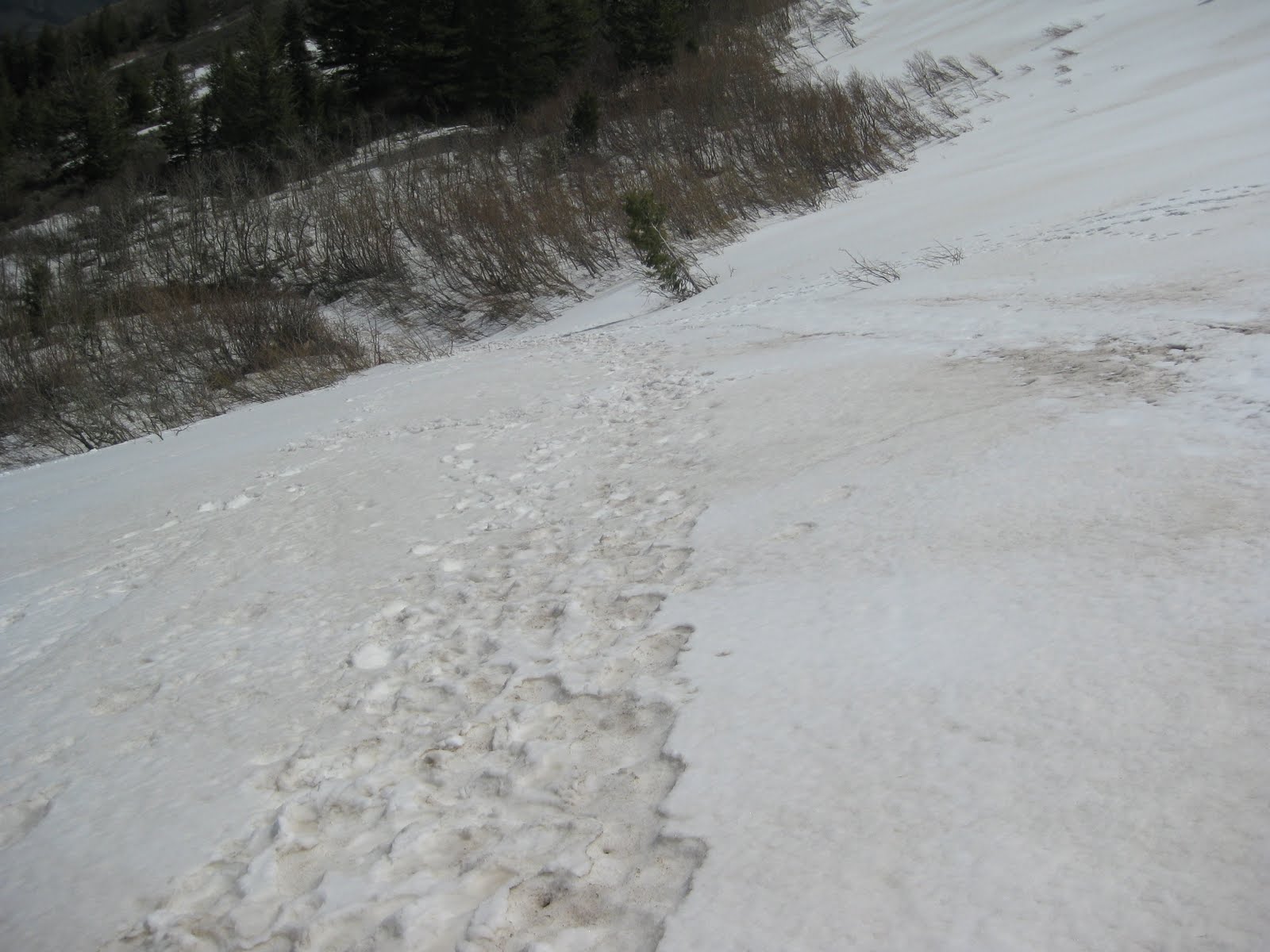 Mile 12.5. Beginning of the descent and likely the first encounter with snow. The descent is on a steep, rugged, rocky, switcbacking road with sporadic patches of snow, ice, mud, and runoff likely. Fun! After a couple miles, a left turn is taken onto buttery singletrack through the grassy fields and dumps out onto the first major aid station at the end of leg 1 at mile 16.9 (el. 4500ft). Whew! Better hope you haven't trashed your quads already!
 Climbing out of the aid station is the beautiful City Creek trail. Definitely one of the prettiest stretches of the entire course. So gentle is the climb for 3 miles, but then comes the true test: The crap chute! At first, I thought there was less snow than last year and surprisingly no runoff streaming down.
 But I was wrong. At this point, there is more snow than last year (much of it should melt...?) and the runoff didn't appear to have begun yet. This could very well turn into the same slick, muddy, sloppy, slippy climb up a river of melting snow that I remember. Yeeeaahhh! Definitely one of the highlights of the race!
 After reaching the crest at mile 22 (el. 7200ft), there's a long stretch of smooth rolling doubletrack that slowly descends to the next aid station at mile 26. From here, there's a 500ft climb that could also still have snow patches unless the weather turns quite warm. It's all north facing and shaded and this is what it looks like now. Mostly snow-covered and pretty slow-go'in.
 After the crest of that 1 mile climb, the trail is mostly flat or gently downhill for the next 2 miles. Most of this snow should be gone by race day as it's almost gone now and sits out in direct sun. This was a slooooooow slushly section for me with all the stretches of slush to slog through.
 Mile 29. Turn off onto the West Fork Trail (el. 6200ft) and 1,000 ft to go to the end of leg 2. Again, on a north facing, shaded slope. If it's not too warm over the next three weeks, there could still be snow here too. But with warm temps, it could melt off quickly.

Captain Xenolith


 The Outsiders
On the crest of the Dihedrals looking West at the Cascade Volcanoes. ???
(I see Black Butte. The one on the right)
 Rappelllllllll!!! Bye Joe!
Sunday, May 2, 2010
R2R2R + R2R
 A striking and spectacular vantage 1,500 ft above the Colorado while descending the South Kaibab Trail
 I left the South Kaibab Trailhead (el. 7,000 ft) at 8:00am and this is what I was looking at. It was absolutely pouring. Bummer. The middle of the trail was a river of fast-flowing mud mixed with mule urine and feces. Double bummer. And four minutes down the trail... BAM... the business end of a loooooooong mule trail. Trifecta. Luckily, the aft-most mule train captain somehow noticed me behind and yelled up to the mule train captain in front to stop and let me pass. It took all of about 2-3 minutes. But I still wished I had left ten minutes earlier!
After 20 minutes and 2,000 ft down, the rain finally let up and I took off my jacket. It was much warmer down here too. And there were a surprising amount of people going down and coming up given the nasty weather and it being a Wednesday. And then, about 20 minutes and 1,000 ft below, on a striking red/green plateau, I froze in my tracks. I stared, unmoving, witnessing one of those sights beyond beauty. There were others doing the same. Nothing moved. It was silent. I could've stayed a while, but I couldn't. In that moment, time seemed to stand still, but it wasn't. I had to keep moving. Quickly. I packed the camera away and continued down knowing full-well that it would probably be a long time before I witnessed anything like that again here.
 The most beautiful of Grand Canyon scenes
I hit the black bridge (el. 2,500 ft) in 57 minutes, crossed the Colorado and continued right on past Phantom Ranch without stopping. I knew I could make it to Cottonwood with the two bottles I started with. It wasn't especially warm and it was very humid making hydration much easier. I passed through the "box" and continued up the wider part of the North Kaibab canyon reaching Cottonwood (el. 4,000 ft) in 2:15. I refilled my bottles. So far, I had only consumed two, half-bottles. (I had mixed double-strength drink mix into each bottle so I could drink the first half of each at double strength, then fill up and continue on with a normal mixage.)
I hit Roaring Springs Pumphouse (el. 4,500 ft) at 2:35 and floated right on up the trail running virtually all of it (except for the steep stair sections) right on up to the high bridge at 6,000 ft. From there, it began raining steadily again and water was cascading off every cliff face and pouring onto the trail like gigantic showers. I walked/ran most of the rest of the climb until 7,000 ft where snowdrifts remained and became larger and larger as I ascended up to the North Rim trailhead at 8,200 ft where it was solid snow four feet deep.

I hit the North Rim in 4:05. Took two pictures. Ate three Shot Blocks and a half tube of honey roasted cashews. And turned back down the trail.

I made it back to the pumphouse in 65 minutes (5:10) and stopped to refill water. 15 minutes later (5:25), I was back at Cottonwood and cruised on by.

Another 65 minutes (6:30) and I was back at the Colorado refilling water at the spigot just across the creek preparing for the final push. I knew I was getting low on food, but hoped I had anough pep in my step to make quick work of this brute of a climb back up to the South Rim. I slipped into my comfortable and familiar shuffle, up to the bridge, across through the tunnel and began my way up.

I knew right away, this would soon turn out to become more of a struggle than I intended. But then again, have ANY of the climbs back up to the South Rim EVER NOT been a struggle?!?! Nope. Wishful thinking, my friend. Dream on...
The short of it is, I took the last of my food after an hour of climbing at around el. 4,500 ft. I still had 2,500 ft to climb and it would take me another hour and twenty minutes of painful suffering to get there. It became very windy. Very cold. Very miserable. I thought I was going to go delerious. And then, after countless steps up over those %#@#! wood stairs, I was at the top where everything was coated in a fresh white layer of snow for the upper 500 ft.

I was knackered. Finished at 5:10pm, 9 hrs, 10 min after stepping off this very cliff. And very hungry. And very cold. And without any time to rest or recover, I walked back to the car, changed my shorts, and raced off back to Phoenix to pick up my parents at the airport. (Happy birthday Mom! Sorry I was a few minutes late! But it sure was good to see you both!)
The next Monday, after hanging out in Phoenix with family for four days, I found myself again looking across the Canyon, this time on a beautifully bright, crisp spring morning and this time headed down the Bright Angel trail with the intent to do another R2R2R.

 Looking down on Boat Beach and the connector trail between the black bridge (S Kaibab) and the silver bridge (Bright Angel). They are only about a half mile apart and are apparently the only two spans across the Colorado in a 277 mile stretch.
 Looking over at the silver bridge (far left, kind of camoflauged) and Phantom Ranch (with all the leafy cottonwood trees)
 Here is a close-up. I couldn't tell if that's a bird in there, or not.
 About 500 vertical ft below the rim, there were three condors gliding on the thermals above, but I only got a photo of these two. Magnificent. The crowds of people were everywhere, stopped and staring upwards with cameras and binoculars out.
 It took me exactly 2 hrs to reach the top from the spigot at the bottom. On a good day, fresh, I think I could hammer this climb in around 1:45. But I'll never be able to do it without descending 4,500 ft first and, more likely, after going up the 5,5oo ft over to the North Rim and Back. But considering I did make a few short stops along the way and I still wasn't fully recovered from the last run, I think a 2 hr climb would be possible after a full crossing. Which means I would be looking at an 8 1/2 hour R2R2R. And, with better weather and no snow on the north side, I think another 15 minutes could easily come off of that and possibly more? Hmmmmmmm... That'll have to wait.