Here's a little sample-platter of my most recent adventure: a run from the South Rim of the Grand Canyon, across to the North Rim, and back. 48 miles. 12,000+ ft of elevation gain/loss. 14 hours.
Our adventure begins... And along with the obvious goal of making it all the way accross and back in one day, another challenge quietly lurked in the background: Saving the battered platoon of toenails. Last year, we sustained two casualties. This year, we were aiming to cut our losses.
There were 20 strong soldiers that began the day with us. Our hope was to have them return healthy and uninjured after all was said and done. There was one member of the group that would be watched slightly more than the others. It seems this brave warrior had already sustained injury during a previous battle and would be starting this battle already a little bit dazed and confused. The mission: Protect the healthy 19 and prevent further damage to the 1.

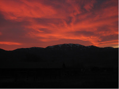
If it looks cold, well, it was 24 degrees with a bitter-cold wind whipping up at us from below. Brrrrrrrrr!We started heading down from the South Rim on the Bright Angel trail at 0600 under the cover of darkness so they wouldn't see us coming. Our goal was to make it as far down into the depths of the canyon before we were spotted. Elevation 6,900 feet.

The fierce and icy wind was whipping dust all over us and although it stung our eyes and choked our throats, I'm sure it helped camoflage our descent. In this photo, you can see the dust particles flying in the air as we ran further down the canyon. This was about 45 minutes and 2500 feet into our descent and our first approach to the Colorado River. So far, nobody had spotted us. Our plan was working beautifully.

We stopped at the Indian Gardens campground to declothe a bit since it was much warmer here. We were already 60 minutes and 3,000 down and the toe platoon was fully intact and working comfortably. We could still see the lights of the South Rim buildings. Ten minutes later after packing away our extra clothes, we were off again. The campers were just beginning to rustle about. I think we were spotted, but quickly disappeared just as quietly and mysteriously as we had arrived. It was getting lighter now so we would have to be more careful.

This is the Indian Gardens Ranger Station at first light.

This is one of my favorite sections along the Bright Angle Trail just below Indian Gardens. I refer to this section as "The Ledges".
 Descending into "The Corkscrew". 0730 hours. 1 hour, 30 minutes, 20 healthy toes, and 3,500 feet down.

Upon exiting the side canyon we had been descending, we turned upriver for a mile or so. Just around the bend is the Silver Bridge. Elevation 2,400 feet.
 Our "thundering hooves" crossing over to the north side of the river. This bridge has a see-through steel grating so as we crossed, we could look down at the frothing green Colorado River a hundered feet below our feet. The grating was a bit loose so as we ran, our pounding feet created a racket that I'm sure warned everyone on the north side of the river of our presence. 0810 hours, 2 hours, 10 minutes and 10 miles into our run. We stopped for another 10 minutes to shake down our clothing, refill our water, and use the lavish outhouses, then, soon, our 20 happy toes were on the run again.
 Negotiating "The Box", a narrow 3 mile section of the North Kaibab trail just above the Colorado heading towards the North Rim. This is an obviously very scenic part of the trail with a mellow grade that is comfortably runnable at roughly 300 feet/mile. It was along this gently rolling section that I unintentionally punished my troops time and time again. I was busy watching the colorful sunlight hit the towering canyon walls and must have smacked my toes into the 16 inch high solid rock water bars over ten times. &%$@! By the time we stopped again for water, my two big toenail leaders were hurtin. Boo... = (
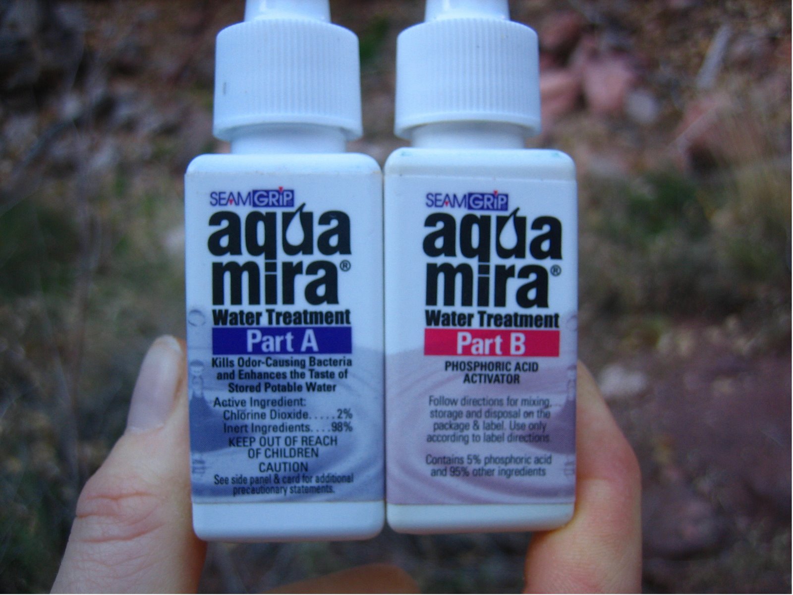 Since the water spigots on the north side had been turned off, we resorted to this purification method: (Part A + Part B) + 5 minutes = No knotted intestines or exploding bowels. We stopped for about 10 minutes 45 minutes prior to this at the Cottonwood Campground. We were stopped for 20 minutes here at Roaring Springs.

Our power hike up to the North Rim. 1140 hours, 5 hours, 40 minutes, 21 miles into our run. Elevation approx. 6,500 feet

500 feet below the North Rim.
 Our route between the North Rim and the Colorado River .

At the North Rim trailhead, our turnaround point. 1250 hours, 6 hours, 50 minutes, 24 miles covered. For the record, last year we made it here 20 minutes faster which I attribute to the fact that last year, we did not stop for 20 minutes to purify our water. But last year, we spent 20 minutes chillin on a log at the top so, essentially, we were on the same pace. And one of us must have wanted to keep it that way by tagging the trailhead and immediately allowing gravity to take hold and be whooshed back down the trail. Time for cookies? No way sucker! We've got a job to do so stuff that cookie in your pocket for later and get those feet a flyin yo!

Our "summit" photo. Taken 500 feet below the summit once we caught back up to each other.

Descending the North Rim and feeling good. Platoon status? One healthy big toenail. Two slightly wounded big toenails with evasive action and damage control measures being presently taken. One big toenail receiving further trauma and is currently deteriorating. The rest of the troops? Giving all the support they can muster.
 This section of the North Kaibab trail was blasted right out of the cliff. It reminded me of the "Light Cycle" scene from the movie Tron, one of my favorite childhood movies. (In the video I have linked here, the part of the scene I was thinking of starts at 4:27 at the very end of the clip)
 Back to the South side! 0430 hours, 10 hours, 30 minutes, 38 miles, and 19 surviving toes into the run. And the 20th? Unfortunately, this little trooper had taken just about all he could take and was swollen and wounded badly, but being the well-trained "tough-as-a-toenail" soldier he is, he continued to press on up the trail. The rest of the way down to the river from the North Rim was a bit of a death march for me. The tendonitisized knees that have nuisanced me since mid-July were making their presence known by the middle of this 5,800 foot, 14 mile descent. Ow, mama!
 After a half hour of crossing the bridge, we began our ascent, it began to get dark, and we began to catch the first of many poor unfortunate souls who had ventured too far down into this ginormous crack in the earth before realizing they were 1. Way too far down to hike out before dark without any sort of lightsource, 2. Way to far down for their out-of-shape bodies to carry them back out, 3. Way too far down for the limited supply of food and water they carried, if they carried any at all, 4. Not going to get any sympathy from two well-trained, well-prepared trail runners working into their 42nd mile and 11th hour, and 5. Not capable of keeping up with said well-trained, well-prepared trail runners to mooch off their lights and possibly their food and water (I'm not sure because they didn't last long enough behind us to find out)
 The moon was incredibly bright for our final couple hours. About an hour from the top, the surreal moonlight only added to the erie moment when I suddenly heard the frantic words "Oh No! Oh No! Oh No!" from the dark shadowy trail up ahead. A soldier was down. After stopping briefly to assess, we had no other option but to continue upward. Finally, at 2000 hours, after 14 hours and 48 miles, we were done. We made it with 19 surviving members of our toe platoon. And the 20th? Well, he popped. An hour from the end and the blister that had gradually been forming under the toenail finally burst forth with a gush of blister-fluid. Eww. Gross.

After it was all over standing on the South Rim once again in the darkness.