


 Mile 4. Top of the first 1,000ft climb (el. 6200ft) looking south over Mink Creek at still-snow-covered Scout Mtn. Leg 3 climbs due south along the west slope of Scout (the right side of the peak in this photo), turns east up to a saddle south of the summit, then ascends the south ridge to the long, rolling road to the top before dropping back down over the northeast slope via a loooooong glissade. Yaaaaaaay! Only 39 miles to get there!
 Mile 4. From roughly the same spot looking north at Pocatello.
 Mile 6. Blissful rolling singletrack!
 Mile 10. Sign of things to come. Turn-off from the Gibson Jack trail and beginning of the brutal, thigh-burning, calf-busting, lung-searing, off-trail, straight-up 1,500ft climb. Sah-weet! This is definitely one of the unique trademarks of this race and something that makes this event so challenging. (Don't end up skewered like this guy, there's a long ways to go)
 Mile 10.5. Follow the ribbons and rock cairns. When in doubt, go straight up!
 Mile 11.5. Looking south back down the climb from the top (el. 7200ft).
 Mile 11.5. Same place looking northwest. There's a mile stretch of flat road here on top before the wild descent down. So far, there was only minimal snow patches on the trail which will surely be melted off in three weeks.
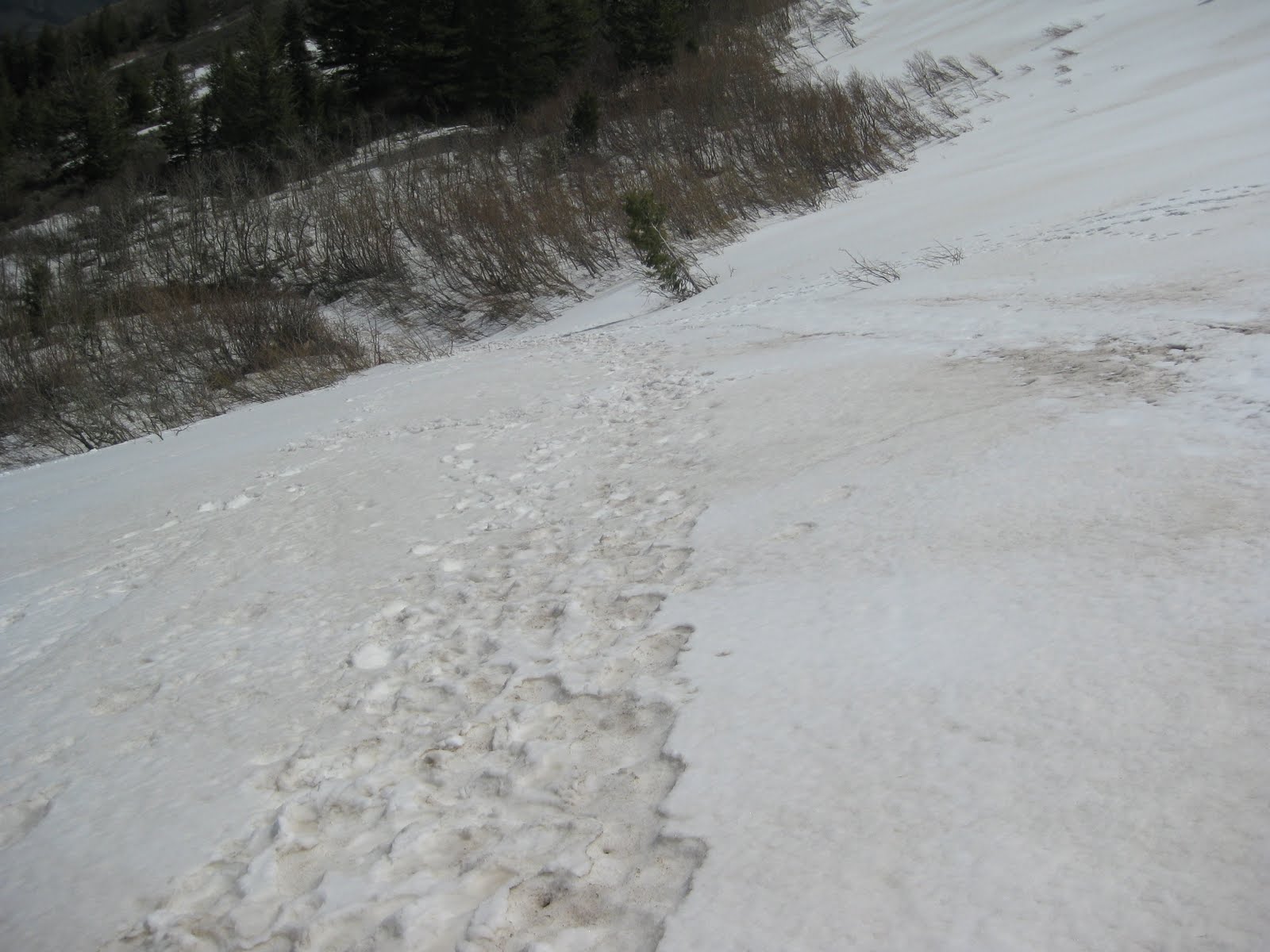 Mile 12.5. Beginning of the descent and likely the first encounter with snow. The descent is on a steep, rugged, rocky, switcbacking road with sporadic patches of snow, ice, mud, and runoff likely. Fun! After a couple miles, a left turn is taken onto buttery singletrack through the grassy fields and dumps out onto the first major aid station at the end of leg 1 at mile 16.9 (el. 4500ft). Whew! Better hope you haven't trashed your quads already!
 Climbing out of the aid station is the beautiful City Creek trail. Definitely one of the prettiest stretches of the entire course. So gentle is the climb for 3 miles, but then comes the true test: The crap chute! At first, I thought there was less snow than last year and surprisingly no runoff streaming down.
 But I was wrong. At this point, there is more snow than last year (much of it should melt...?) and the runoff didn't appear to have begun yet. This could very well turn into the same slick, muddy, sloppy, slippy climb up a river of melting snow that I remember. Yeeeaahhh! Definitely one of the highlights of the race!
 After reaching the crest at mile 22 (el. 7200ft), there's a long stretch of smooth rolling doubletrack that slowly descends to the next aid station at mile 26. From here, there's a 500ft climb that could also still have snow patches unless the weather turns quite warm. It's all north facing and shaded and this is what it looks like now. Mostly snow-covered and pretty slow-go'in.
 After the crest of that 1 mile climb, the trail is mostly flat or gently downhill for the next 2 miles. Most of this snow should be gone by race day as it's almost gone now and sits out in direct sun. This was a slooooooow slushly section for me with all the stretches of slush to slog through.
 Mile 29. Turn off onto the West Fork Trail (el. 6200ft) and 1,000 ft to go to the end of leg 2. Again, on a north facing, shaded slope. If it's not too warm over the next three weeks, there could still be snow here too. But with warm temps, it could melt off quickly.
I didn't mess with the third section as it clearly had alot of snow on it and I knew finding the yet unmarked route would be darn near impossible and maybe a tad bit dangerous. Expect a long 10 mile climb up to the summit and a quick glissading descent off the top!
I absolutely love this course. Always something new. Always amazing views. And such an incredible variety of trail conditions: Smooth & rocky, steep & flat, muddy & dusty, snowy & dry. A perfect and enjoyably brutal challenge.
Are you ready?
1 comment:
Thanks buddy for the great pics. Having never run a step of the course, the pics and your description gave me a sense of what is to come. Can't wait!!
Post a Comment